Strategic Commercial Land Opportunity — EU–Ukraine Logistics Gateway
An exceptional investment opportunity:
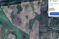
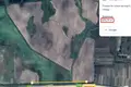
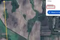
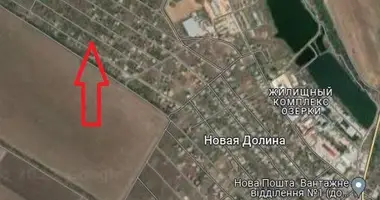
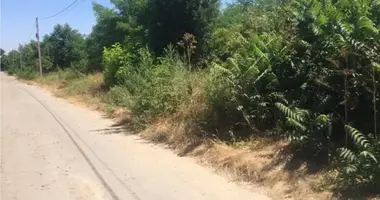
86.86 hectares of pre-zoned, infrastructure-ready commercial land located just 15 km from the Yagodyn–Dorohusk border crossing — the busiest trade route between Ukraine and the European Union.
Positioned in Kotsyury village, Volyn Region, this site offers immediate access to key regional logistics hubs:
-
Fast highway connections to Lublin (92 km) and Lutsk (118 km)
-
Mixed-use zoning with approved urban planning conditions
-
Direct access to railway infrastructure (connection to be established)
Land status:
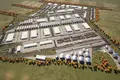
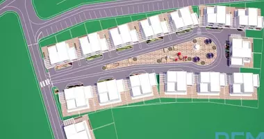
Master-Planned for Industrial & Logistics Development
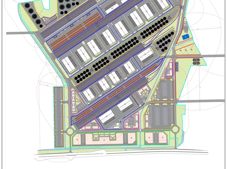
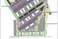
The site includes a clear functional zoning structure:
-
Logistics zone (9.3 ha): container terminals, A+ warehouse class, equipment service
-
Transport area (7.01 ha): TIR maneuvering & rest stops
-
Storage zone (13.82 ha): fuel base, silos, grain elevators, cleaning/drying stations
-
Administrative & service area (4.98 ha): customs warehouse, business offices
-
Scientific/industrial zone (12.53 ha)
-
Infrastructure & utilities (5.55 ha): power substation, water systems, railway access points
-
Trade zone (5.39 ha)
Ideal for:
-
Cross-border logistics centers
-
Agricultural export terminals
-
Industrial manufacturing clusters
-
Warehousing parks or bonded logistics zones
-
Institutional-scale development
Infrastructure Highlights
-
Electricity: Possibility to connect power supply on site
-
Rail Access: Possibility to establish railway connection on land plots (both wide and narrow gauge)
-
Urban Planning: Zoned and legally cleared for development
-
Ownership: Combination of private and leased land, fully registered and transaction-ready
Legal & Cadastral Information
The property is registered in the State Land Cadastre of Ukraine.
Private ownership plots — cadastral numbers:
-
0723380400:04:009:0216 — 3.1811 hectares
-
0723380400:04:009:0217 — 3.1083 hectares
-
0723380400:04:009:0522 — 2.16 hectares
-
0723380400:04:009:0623 — 2.51 hectares
-
0723380400:04:009:0505 — 2.6964 hectares
-
0723380400:04:009:0420 — 1.8101 hectares
-
0723380400:04:009:0425 — 2.0872 hectares
Leased plots — cadastral numbers:
-
0723380400:04:009:0380 — 54.8513 hectares
-
0723380400:04:009:0439 — 3.5021 hectares
-
0723380400:04:009:0521 — 10.967 hectares
Why This Location?
-
Positioned on the EU’s eastern border — ideal for logistics between Poland, Ukraine, and Black Sea ports
-
Part of Ukraine’s growing trade and infrastructure corridor
-
Potential for international partnerships or co-financing
Contact for full documentation, site maps, and pricing. Investor deck and concept plan available upon request.