Umożliwiają przeglądanie zawartości witryny i uzyskiwanie dostępu do funkcjonalności. Tego typu pliki cookies wykorzystywane są wyłącznie w celu prawidłowego działania serwisu i nie są przekazywane podmiotom trzecim. Wyłączenie nie jest możliwe bez zakłócenia funkcjonowania serwisu.
Analityczne pliki cookie
Pomóż nam ulepszyć wydajność witryny, Twoje doświadczenie korzystania z witryny i uczynić ją wygodniejszą w użyciu. Informacje gromadzone przez tego typu pliki cookie są zbiorcze i dlatego anonimowe. Służy do dostarczania statystycznych wskaźników korzystania z witryny bez identyfikacji użytkowników.
Reklamowe pliki cookie
Pozwól nam obniżyć koszty marketingu i poprawić komfort użytkowania.
Realting.com wykorzystuje pliki cookie, aby usprawnić Twoją interakcję ze stroną internetową. Możesz skonfigurować, które pliki cookies będą zapisywane na Twoim urządzeniu.
Dowiedz się więcej
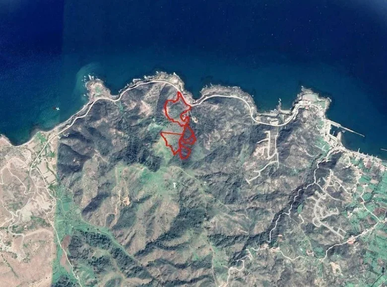
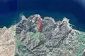
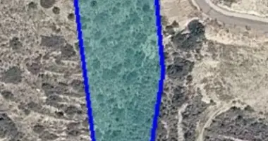
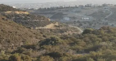
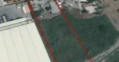
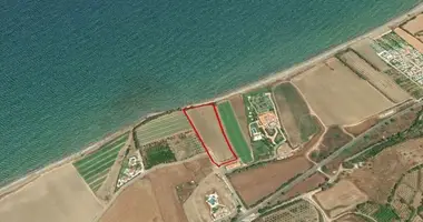
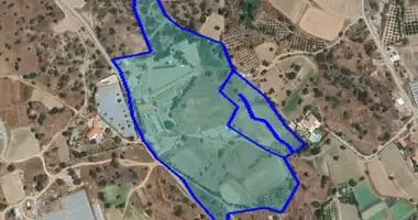
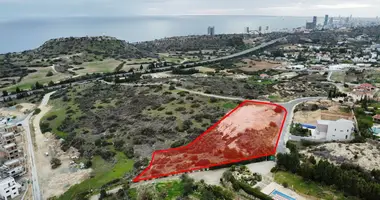
5 sąsiadujących pól w Pigenia, Nikozja District. Korzysta z ładnego widoku na obszar i morze. 1.Plot o łącznej powierzchni 10.368 m2 ma nieregularny kształt i nachylenie powierzchni, jest uważany za lądowe i mieści się w strefie rolnej (Γ3). 2.Plot o łącznej powierzchni 26.756 m2 ma nieregularny kształt i nachylenie powierzchni, znajduje się w strefie rolnej (Γ3) i zawiera zarejestrowaną ścieżkę (granica północna). 3.Plot o łącznej powierzchni 51.200 m2 ma nieregularny kształt i nachylenie powierzchni, ma front drogowy około 240 metrów wzdłuż drogi przybrzeżnej, która prowadzi do Kato Pyrgos wzdłuż granicy północno-wschodniej i mieści się w podwójnej strefie planowania mieszkaniowego (H4 ok 19.456 m ² i H5 circa 31.744 m ²). 4.Plot o łącznej powierzchni 12.375m2 i ma nieregularny, ostry kształt z nachyleniem powierzchni, jest zablokowany (c 200 metrów na południe od najbliższej zarejestrowanej drogi), kończy strumień rzeki (północno-zachodnia granica), jest przekroczony przez strumień rzeki i mieści się w obszarze planowania mieszkaniowego (H4). 5.Plot o łącznej powierzchni 6.335m ² i ma nieregularny, ostry kształt z nachyleniem powierzchni, jest zablokowany (c 200 metrów na południe od najbliższej zarejestrowanej drogi) i mieści się w obszarze planowania mieszkalnego (H4). Bezpośredni obszar obejmuje niektóre rozproszone zabudowy mieszkaniowe, a w jego większości lasy i puste działki gruntów.
Po kliknięciu przycisku "Potwierdź" otrzymasz debet w wysokości 50 realtek (5 EUR) na opłatę za Superlink z Twojego salda w myAlpari
Zapłać 5 EUR
Anuluj
Kliknij przycisk "Zapłać", zostaniesz automatycznie przekierowany na stronę doładowania, ponieważ nie masz wystarczającej ilości realtek na swoim saldzie
Superlike!
Ten artykuł został już oznaczony. Aby anulować superlink, kliknij "Anuluj".
Zwróć uwagę, że w przypadku anulowania superlinku, opłaty za zakupy nie zostaną zwrócone.
Usuń
Pozostawić na
Klikając "Unsubscribe" anulujesz superlink bez zwracania jakichkolwiek reelts na swoje saldo.
Udostępnij tę rekomendację!
Otrzymuj procent udanych transakcji, polecając nieruchomość za pomocą poniższych linków!